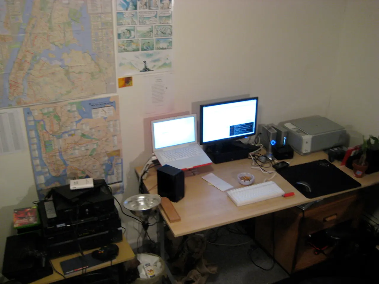
Affordable chart plotter constructed using Raspberry Pi and Open Plotter software
In this article, we'll guide you through creating an affordable, powerful, and customisable chart plotter with AIS (Automatic Identification System) for your boat. The system we'll be using is based on a Raspberry Pi, Open Plotter, and a USB TV tuner for radio signal processing.
## Hardware Requirements
To build this system, you'll need the following hardware:
- Raspberry Pi (Model 3B+, 4, or 5 for optimal performance) - Official Raspberry Pi power supply - MicroSD card (32GB+) - USB TV Tuner (e.g., RTL-SDR-based, widely compatible and economical) - AIS Receiver (or VHF antenna and splitter if integrating with existing VHF radio) - Waterproof enclosure and marine-grade cables (for durability) - Display (HDMI touchscreen or waterproof marine monitor) - GPS Module (USB or serial-connected, many are plug-and-play) - Optional: NMEA 0183/2000 interface for integrating with existing boat instruments
## Software Stack
- Raspbian/Raspberry Pi OS (headless or desktop, as preferred) - Open Plotter (marine OS for Raspberry Pi) - OpenCPN (chart-plotting, navigation, and AIS display) - Signal K (modern, JSON-based marine sensor data protocol) - Software for AIS decoding (e.g., `rtl_ais` if using RTL-SDR, integrated with Open Plotter) - Chart downloader (within OpenCPN for free ENC/vector charts)
## Setting Up Your System
### 1. Install Open Plotter on Raspberry Pi
- Download the Open Plotter image and flash it to your microSD card using Balena Etcher or similar. - Insert the microSD into your Raspberry Pi, connect power, display, keyboard, and mouse. - Boot and follow initial setup prompts (network, user, etc.).
### 2. Connect Hardware
- Plug in the USB TV tuner (RTL-SDR) for AIS signal reception. - Connect the GPS module (USB/serial). - Attach a VHF antenna to the TV tuner’s SMA input (use a splitter if sharing with your VHF radio). - Optionally connect NMEA serial devices for depth, wind, etc.
### 3. Configure Open Plotter
- Open the Open Plotter Settings app. - Go to Signal K and enable it—this will handle sensor data aggregation. - Go to AIS settings and select your RTL-SDR device. Most common USB SDR sticks are auto-detected. - Set the correct frequency for AIS (usually 161.975 MHz and 162.025 MHz). - Enable AIS decoding software (often pre-installed; Open Plotter may use `rtl_ais` or similar).
### 4. Install and Configure OpenCPN
- OpenCPN should come pre-installed with Open Plotter; if not, install it using the package manager or Flatpak[3]. - Launch OpenCPN. - Go to Options > Connections and add a Signal K connection (localhost, usually port 3000). - Go to Options > Charts and use the Chart Downloader to add free chart catalogs for your cruising area. This improves coastal detail beyond default basemaps[1]. - Optionally, add paid or official charts if required.
### 5. Test and Optimise
- Verify AIS targets appear in OpenCPN (nearby ships, names, MMSI, speed, heading). - Confirm GPS position is accurate and updates in real time. - Integrate additional NMEA instruments if desired. - Consider web-based dashboards (Signal K-Node-RED) for advanced customization.
## Advanced Tips
- Headless Operation: Use VNC or SSH for remote access; configure auto-start services. - Backup Power: Add a small UPS or battery for graceful shutdowns. - Chart Updates: Regularly update charts via OpenCPN’s downloader. - Custom Integrations: Use Signal K’s plugin system for alarms, logging, or IoT integrations. - AI/Computer Vision: For experimental projects, Raspberry Pi 5 + AI Kit can add object recognition or collision avoidance, though this is beyond standard chart plotting[2].
## Cost Considerations
- Raspberry Pi 4/5 + accessories: ~$100–$150 - USB TV Tuner (RTL-SDR): ~$20–$30 - GPS Module: ~$20–$50 - Display: $50–$200 (marine displays cost more) - Cables, enclosure, antenna splitter: ~$20–$50 - Software: Free (Open Plotter, OpenCPN, Signal K, rtl_ais)
This DIY solution is far more economical than commercial marine plotters, which often cost $1,000+ for equivalent functionality.
## Conclusion
By combining a Raspberry Pi, Open Plotter, a USB TV tuner (RTL-SDR), and open-source marine navigation software, you can build a powerful, customisable, and economical chart plotter with integrated AIS for your boat. The process involves flashing Open Plotter, connecting and configuring hardware, setting up Signal K for data aggregation, and using OpenCPN for chart display and navigation—offering a professional-level system at a fraction of the cost of commercial units[1][3].
With the gathered gadgets and technology components, we can further enrich our navigation experience. For instance, integrating navigation gadgets within the system, such as depth and wind sensors, will provide more comprehensive data for safer boating.
Furthermore, gadgets like software for AI and computer vision, such as the Raspberry Pi 5 with an AI Kit, can offer experimental projects like object recognition or collision avoidance, enhancing the plotter's functionalities beyond standard charting.


